Frequently Asked Questions
-
The Goldfield Corridor is located along Goldfield Drive and intersects property owned by the Fountain Valley School, the Bluestem Prairie Open Space, and land bordering the Big Johnson Reservoir. It is in southeast El Paso County near South Powers Boulevard and Fontaine Boulevard. The Corridor has been identified in a previous Fountain Mutual Metro District master plan as a potential trail connection linking parks, open spaces and communities.
The principal features of the Goldfield Corridor are the 646-acre Bluestem Prairie Open Space and the Big Johnson Reservoir 286-acre area. A concept developed by stakeholders represents a conversation about using Goldfield Drive to connect the Bluestem Prairie Open Space to a larger trail network and build a loop around the reservoir. Foot traffic suggests a demand for a larger trail system.
-
Fountain Mutual Metro District (FMMD) is a governmental, quasi-municipal entity that was created to serve two primary functions: stormwater management and parks and recreation.
-
FMMD is conducting and funding the Goldfield Corridor study in partnership with other stakeholders and property owners including:
City of Colorado Springs Parks, Recreation and Cultural Services
Colorado Springs Utilities
El Paso County Parks
El Paso County Transportation
Emergency Responders
Fountain Mutual Irrigation Company
Fountain Valley School
Palmer Land Conservancy
Trails and Open Space Coalition
and others
-
The Goldfield Corridor and Bluestem Prairie Open Space is the closest prairie open space to Southeast Colorado Springs at approximately 1.5 miles. Expanding access to the open space and connections to regional trails would provide a recreational destination for residents in this area of Colorado Springs and for the broader community as well.
It is a protected wildlife habitat that supports migratory waterfowl and shorebirds as well as nesting habitat for bald eagles and other year-round species. Due to the expansive open space, the area is ideal for hiking, biking, waterfowl and birdwatching, educational nature walks, wildlife spotting, photography, dark sky viewing, and youth biking and educational events.
Approximately 279 bird species have been recorded on the surrounding property. During birding season (April and May), visitors use the parking lot associated with the trailhead near the southern end of Goldfield.
Bluestem Prairie Open Space is a rare piece of protected bluestem prairie. Originally part of the Banning-Lewis Ranch, Bluestem Prairie comprises 646 acres of prairie grassland. Historic ranch buildings sit at the heart of the property, surrounded by aging fencing and a quietly stoic windmill. Bird watchers should be on the lookout for Red-tailed hawks, Burrowing owls, and migratory shorebirds, among others.
For more, visit the Palmer Land Conservancy website: https://www.palmerland.org/blog/find-a-trail-bluestem-prairie-open-space
THE GOLDFIELD CORRIDOR
GOLDFIELD CORRIDOR CONCEPT PLAN
-
The concept focuses on the regional landscape and trail connectivity. The Goldfield trail can connect communities and open spaces on the northern and southern ends to existing trail systems.
The proposed objective is to create a more connected open space with trail access and trailhead parking. Converting a section of Goldfield Drive (between the back entrance of Fountain Valley School and just north of the Sun Ridge neighborhood and Fontaine Boulevard) would reestablish public safety and enable re-purposing the road into a trail that connects to other existing trails in the area. Converting Goldfield to a trail could strengthen conservation goals since vehicle traffic would no longer be utilizing this major collector road.
EXISTING CONDITIONS
-
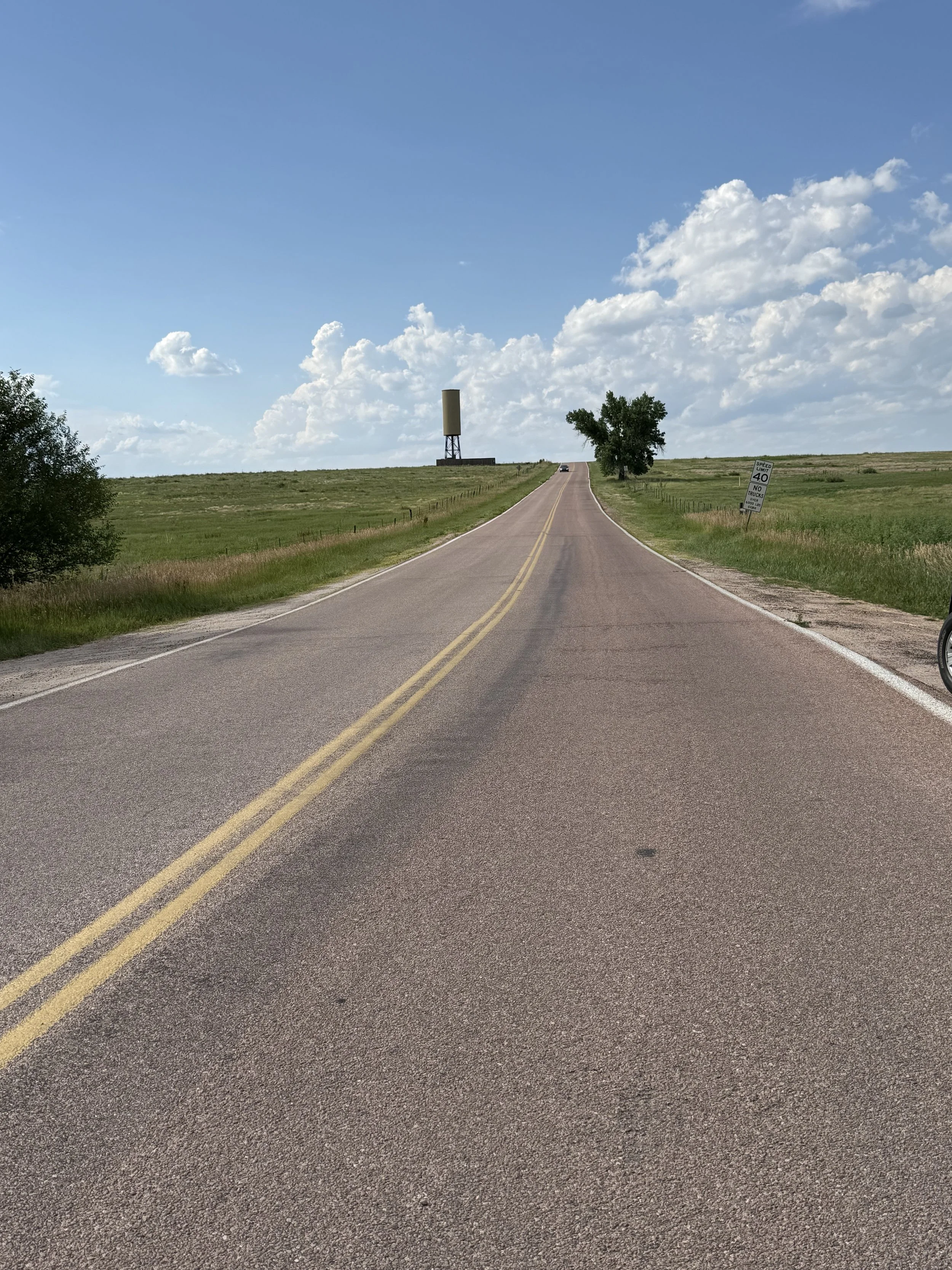
Goldfield Drive is a major collector road between Bradley Road and Fontaine Boulevard. It provides limited access to Fountain Valley School property and to the Fountain Mutual Irrigation Company’s maintenance facility. The adjacent Bluestem Prairie Open Space is currently used by hikers, mountain bikers and bird watchers; however, there is no public access to Big Johnson Reservoir itself. The concept plan would create an opportunity for a new non-motorized trail experience around the reservoir. There are existing trails in the Bluestem Prairie Open Space, but parking for the current open space is limited.
-
Big Johnson Reservoir and the immediate area around it are owned by the Fountain Mutual Irrigation Company (FMIC). Critical water rights are managed by FMIC . The Bluestem Prairie Open Space around Big Johnson Reservoir is owned by the City of Colorado Springs, with a conservation easement managed by Palmer Land Conservancy. Priorities include recreation, and habitat management.
Additionally, critical utility easements for Colorado Springs and El Paso County pass under and are proximal to Goldfield Drive. Fountain Valley School maintains adjoining properties and critical habitat.
-
Several factors drove stakeholders to reimagine a new vision for the management of Goldfield Drive. Those with property adjacent to Goldfield Drive, such as Fountain Valley School and Fountain Mutual Irrigation Company, have observed illegal activities occurring on the road at night. These activities, including illegal dumping and vandalism, threaten the safety of people and private property. On a more positive note, the FMMD Trail Master Plan identified Goldfield Drive as a way to build an interconnected trail system throughout Security/Widefield and Fountain.
The combination of both ongoing challenges on Goldfield Drive as well as a unique opportunity to increase recreational value and trail connectivity led partners to develop a concept plan. The concept plan describes closing and re-purposing Goldfield Drive into a recreational trail, creating public parking lots at the north and south ends of the new trail, and connecting what would become a new trail to the existing open space trail system. These modifications would open non-motorized access to more of the open space areas.
-
Yes, in 2024 a traffic impact study was conducted by the consulting firm of SM Rocha focusing on traffic volumes to examine how traffic patterns would change if Goldfield Drive were to be converted to a trail. Results show that closing Goldfield does not add traffic but will redistribute it.
If Goldfield Drive were converted to a trail, the traffic study recommends construction of a southbound left turn lane along Grinnell and Fontaine and lengthening of certain turn lanes to meet county standards by 2044.
Traffic counts were collected during peak hours on April 4, 2024, from Grinnell Boulevard, Bradley Road, Fontaine Boulevard and Goldfield Drive. The study indicated that:
2,100 trips occurred in a 24-hour period with an estimated 2 percent growth per year projected.
The number of trips on the northern portion of Goldfield was slightly higher than the southern portion.
The higher number of trips occurs around the north gate of Fountain Valley School where this changes, as it correlates with school hours.
The following are base assumptions in the study:
A 2 percent annual growth rate.
Future adjacent developments will generate additional traffic.
The traffic impact study did not account for the proposed connection between Bradley and South Powers.
Traffic congestion on Goldfield crossing through Fontaine would be alleviated, but there would be slight increases in traffic at the Grinnell/Fountain Valley School Road intersection. All other studied intersections are projected to operate within county standards.
-
The El Paso County Sheriff’s Office responded to 205 calls for service from the road during 2022. Ninety-nine percent of those were initiated by officer’s patrolling the area. The Sheriff’s Office recorded 42 traffic accidents in the area, including the intersections of Fontaine Boulevard and Goldfield Drive, as well as at Bradley Road and Goldfield Drive.
Consistent instances of “unauthorized dumping” (furniture, appliances and other large items) occur weekly and often daily along Goldfield Drive, with the majority happening in the large gravel lot near the Fountain Mutual Irrigation Company.
-
The proposed changes to the Goldfield Corridor are not development driven. The changes would be for the purpose of expanding non-motorized access to the open space.
GOLDFIELD CORRIDOR OPPORTUNITIES & BENEFITS
-
The 2019 Master
Trail Plan conducted by the Fountain Mutual Metro District presents opportunities to expand recreation, enhance wildlife habitat connectivity and connect trails on the north and south side of the Bluestem Prairie Open Space. Recent events such as crime and unauthorized dumping have prompted a discussion surrounding converting Goldfield Drive to a recreational trail.
-
An opportunity exists for minimizing road traffic in the area, for increased public safety, and creating a contiguous natural area that fits with the regional land uses. The concept plan also includes the possibility of making an existing out and back “lollipop” trail into a loop trail around the reservoir, while diverting trail traffic away from illegally using the top of the dam as a social trail.
-
Converting the road to a trail will enhance trail connections in the area, hiking, biking, bird and waterfowl watching, photography, wildlife, dark sky viewing, and youth ecological education programs. Trails will be ADA compliant and accessible.
CHALLENGES
-
One of the biggest challenges is the land ownership of specific locations along Goldfield Drive. El Paso County owns the parking lot for the open space preserve, the City of Colorado Springs owns the surrounding fields, and additional county land surrounds the two. In addition, the Fountain Valley School owns the property to the west. Stakeholders have agreed that ownership will be a key consideration of the conversation for future changes.
Various groups would still need access to Goldfield Drive if it was closed, such as utility companies, emergency responders, law enforcement, and construction personnel.
The one lane segment on Goldfield Drive is a challenge. Guardrail improvements may be needed. Representatives from the county confirmed that expanding the bridge to a two-lane cross-section on Goldfield Drive is cost-prohibitive and unlikely. The bridge is safe for all vehicles and is not weight restricted.
A Traffic Impact Study has been completed citing data regarding vehicle volume.
Increasing recreation opportunities along Goldfield can potentially increase the number of recreation-related accidents, such as snakebites.
MAINTENANCE
-
Maintenance of the northern part of Goldfield Drive, from Bradley Road to the back entrance of Fountain Valley School would be the responsibility of the school. A Memorandum of Understanding between the Fountain Mutual Metro District and other stakeholders would be developed for shared maintenance responsibility of the trail. The City of Colorado Springs Parks, Recreation and Cultural Services currently manages Bluestem Prairie Open Space and could maintain the loop and trailheads. El Paso County taxpayers would no longer be responsible for maintaining the road or plowing snow.
-
Yes. A new trailhead and parking area are proposed for both the north and south ends of the existing road. Approval by the Palmer Land Conservancy would be needed.
The proposed northern parking lot/trailhead would be along the Goldfield Drive corridor near Bradley Road. The parking lot would be situated far enough south to not interfere with the future expansion of Bradley Road planned by El Paso County. The southern parking lot/trailhead would be north of the Sun Ridge neighborhood and Fontaine Boulevard, connecting to nearby trail networks (e.g., Crews Gulch Trail).
-
The parking lot design concept accommodates emergency service vehicle access on Goldfield Drive without recreational traffic affecting its course. Fountain Valley School has expressed interest in maintaining the parking lot off its property, so the current option is to build on the conservation easement side of the road. The project team could consider minimizing the square footage impacted on undisturbed land.
-
There are proposed options, but the planning team will eventually identify a definitive crossing point. Depending on the placement of an additional trail, the Fountain Valley School Board might need to approve a trail connector if it is on their property.
-
Options for the new trail are gravel, concrete, milling the existing road for the trail surface or allowing the existing asphalt to age. The proposed Goldfield trail would need to adhere to El Paso County Open Space trail standards. The current asphalt mat will likely be used as an interim solution through the end of its life, with a future transition to a soft surface via asphalt milling, and then to a crusher fine surface.
-
Lighting in the parking lots will be explored based on the availability of electrical infrastructure. Lighting would be designed to minimize any light or glare into adjacent properties. Trailhead restrooms and trash receptacles are proposed.
-
El Paso County is interested in legally retaining the Right-of-Way for Goldfield Drive but transferring maintenance responsibility. The bridge will need to adhere to county standards for pedestrians and trail traffic. The existing bridge could use a guardrail repair, but it is safe for vehicular traffic and is not weight limited. Representatives from the county confirmed that expanding the bridge to a two-lane cross-section on Goldfield Drive is cost-prohibitive and unlikely.
ACCESS
-
Gate access at both the north and south trailhead parking lots, like those constructed in other El Paso County parks, has been discussed but needs more analysis.
Two gates, in accordance with the City of Colorado Springs Open Space gate standard, have been proposed along Goldfield Drive.
The northern gate would be placed at the north side of the Fountain Valley School campus. On the southern end, the gate would be placed just north of the new southern parking lot/trailhead. These gates would limit access solely to utility providers, Fountain Valley School, irrigation services, and emergency responders.
The parking lot areas are designed for cars to park away from turnaround zones and off Goldfield Drive to maintain access for emergency vehicles. Proposed features include heavy-duty gates, Americans with Disabilities Act (ADA)-compliant parking spaces, and kiosks with rules and maps, consistent with City of Colorado Springs Open Space standards for parking and signage.
-
Most drivers would use Fontaine Boulevard and Grinnell Street since most trips originate from nearby neighborhoods. Fontaine and Powers boulevards would become the most efficient options if Goldfield Drive were to be converted to a trail.
-
Utility maintenance vehicles and emergency vehicles currently use Goldfield Drive and would be able to continue to do so if the road were converted to a trail. Emergency Responders have estimated that the median response times could increase up to five minutes, depending on conditions.
-
The 2024 Traffic Impact Study results show that closing Goldfield does not add traffic but will redistribute it. If Goldfield Drive were converted to a trail, the traffic study recommends constructing a southbound left turn lane along Grinnell and Fontaine and lengthening certain turn lanes to meet county standards by 2044.
Partners are exploring options for a pedestrian crossing to facilitate the connection between the proposed Goldfield Trail and existing trails, such as the Crews Gulch Trail.
TIMELINE / FUNDING
-
The decision for transitioning Goldfield Drive to a recreational trail will need to go through the El Paso County public engagement process. However, through the Goldfield Corridor concept plan engagement process, stakeholders and property owners are interested in hearing community perspectives and input before determining whether to move forward with the concept plan.
-
More discussions must take place regarding the funding of construction and maintenance of the trail and the road improvements identified in the traffic study, which would likely be funded by a coalition of stakeholders.
PUBLIC ENGAGEMENT
-
Broad community engagement will include neighbors surrounding the Bluestem Prairie Open Space, stakeholders, local community groups, and visitors with a process that includes an online survey, a project website, and communication materials explaining the Goldfield Drive concept plan.
Another component of the community engagement process is both an in-person and virtual open house in December 2025 to present the proposal, engage the community in discussions, answer questions, and provide additional context.
The consultant team will synthesize the community’s feedback from both the survey and the open houses into a final report. This report will include community perspectives on the proposed conversion of Goldfield Drive to a trail.